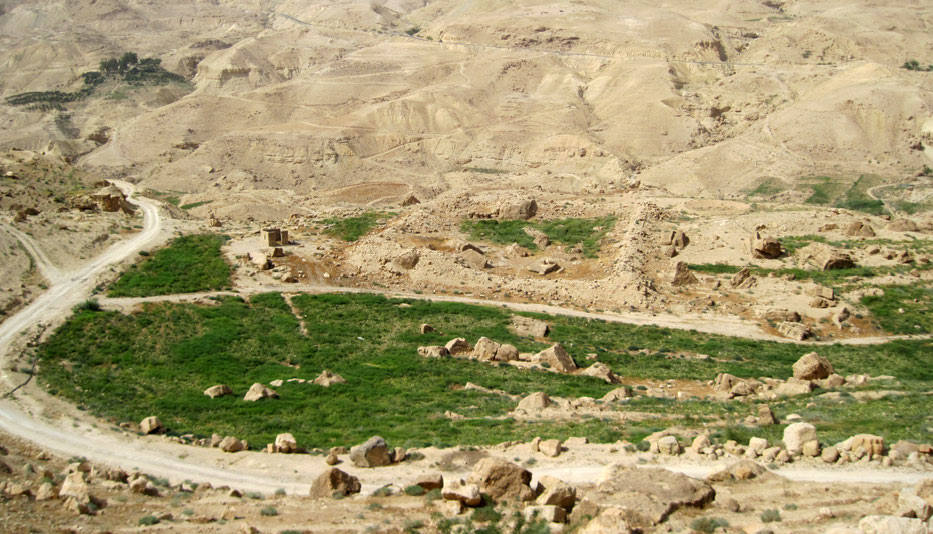
Plan: Square to rectangular (Nabataean / Roman forts).
Measurements: unknown.
Building Materials: local limestone (lower); basalt (upper)
Construction details: unknown.
Preservation: The two sites are both poorly preserved small Roman forts (castella). The surface sherds that Parker and Miller collected were Roman and Byzantine with only a very few Mamluk-Ottoman ones. The name Muḥāṭṭat al-Ḥājj (Station of the Ḥājj) implies that they served as way stations for Muslim pilgrims crossing Wādī al-Mūjib, presumably before the Ottoman constructed their line of Ḥājj stations to the east in the early 16th century.
Inscription(s): none known.
Date(s): The forts are candidates for where the cohors tertia Alpinorum, apud Arnona, the ala secunda Miliarensis, Naarsafari, or the cohors tertia felix Arabum, in ripa Uade Afaris fluvi in castris Arnonensibus were stationed, listed in the Notitia Dignitatum (Or. 37.35, 28, 34).
Traveler Reports: none known.
Bibliography: Provincia Arabia I, 39-41 (lower) 42-45 (Upper); Parker 1986, 55-58; Miller 1991, 35-36, site 18 (upper); Schick 2020, no. 68. [entry written by RS].