Letter Y
434. Yājūz, Kōm | الكوم ياجوز
‘Ammān governorate
Masjid ‘Abd Allāh Ḥājj Dā‘ūd Bāshā
JADIS no. 231 6006
MEGA no. 2657
Coordinates: 32°01'51.7"N 35°55'06.4"E
32.031028, 35.918444
Letter Y
‘Ammān governorate
Masjid ‘Abd Allāh Ḥājj Dā‘ūd Bāshā
JADIS no. 231 6006
MEGA no. 2657
Coordinates: 32°01'51.7"N 35°55'06.4"E
32.031028, 35.918444
Plan: broad rectangular, single door on N long wall; miḥrāb in S wall, not in axis with the entrance door, but slightly shifted to the W. A constructional analysis reveals two construction phases: The first, older one, is preserved by the projecting podium (ziyādeh) along the N and E exterior elevations. The three transversal arches in the interior which intersect the crudely constructed barrel vault belong to a second phase.
Measurements: unknown.
Exterior: unknown.
Interior: unknown.
Building Materials: limestone blocks, the majority reused from older building. The interior S wall has in its upper parts thin limestone beams (125 cm length x 24 cm height) which presumably are the slabs for a flat ceiling of the 1st construction phase.
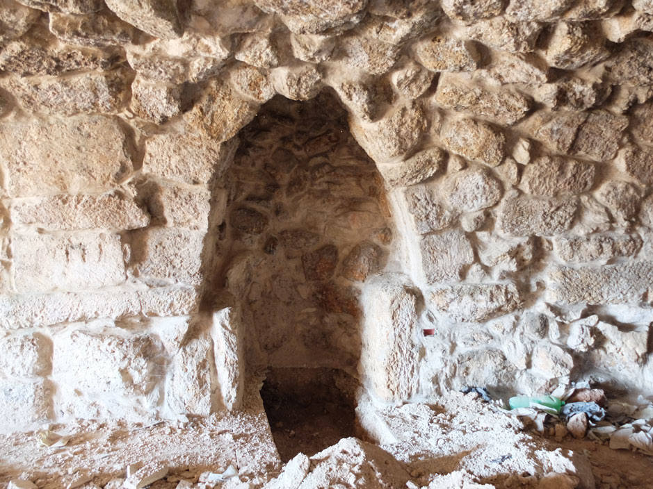
Construction details: The present mosque has been constructed on the foundations of an older structure. This 1st phase building was smaller in its E-W extension, enlarged on both sides during the 2nd phase). In its lower section, the miḥrāb preserves the older semicircular apse flanked on both sides by limestone orthostates.
Preservation: restored,; today abandoned, not in use for Muslim prayer.
Inscription(s): A recent inscription refers to the ownership of Hājj ‘Abd Allāh Dā‘ūd Bāshā:


Translation: “In the name of Allāh, the Merciful, the Compassionate. Allāh [...] Muḥammed. (This is) the mosque of the deceased Ḥājj ‘Abd Allāh Bāshā al-Dā‘ūd.”
Date(s): the 1st construction phase possibly Fatimid (11th century AD). The plan, in general, resamples mosques of the Fatimid period in Busra eski Shām as well as the Fatimid mosque on the ‘Ammān citadel (no. 30); in the 2nd construction phase the former building was largely restored and extended in E-W direction. The roofing was changed from a flat ceiling resting on arches to a barrel vault combined with groin vaults over the miḥrāb and the entrance. In present condition it dates to the late Ottoman period (late 19th or early 20th century AD). Much restoration work has been conducted in recent times.
Traveler Reports: none known.
Bibliography: unpublished
 Fig. 434.1 Sketch ground plan (NJ).
 Figs. 434.2-3 Exterior N elevation with entrance and projecting po- sium (sketch NJ 2018, photo TMW-K 2016).
 Figs. 434.4-5 Exterior S elevation with exterrior blind vaults (sketch NJ 2018, photo TMW-K 2016).