Letter A
33. ‘Ammān | عمّان
al-Maḥatta, former Camp of the Arab Le- gion (‘Ammān Governorate)
Masjid al-Fatḥ
JADIS no. none
MEGA no. none
Coordinates: 31°58'12.9"N 35°58'00.9"E
31.970256, 35.966903
Letter A
al-Maḥatta, former Camp of the Arab Le- gion (‘Ammān Governorate)
Masjid al-Fatḥ
JADIS no. none
MEGA no. none
Coordinates: 31°58'12.9"N 35°58'00.9"E
31.970256, 35.966903
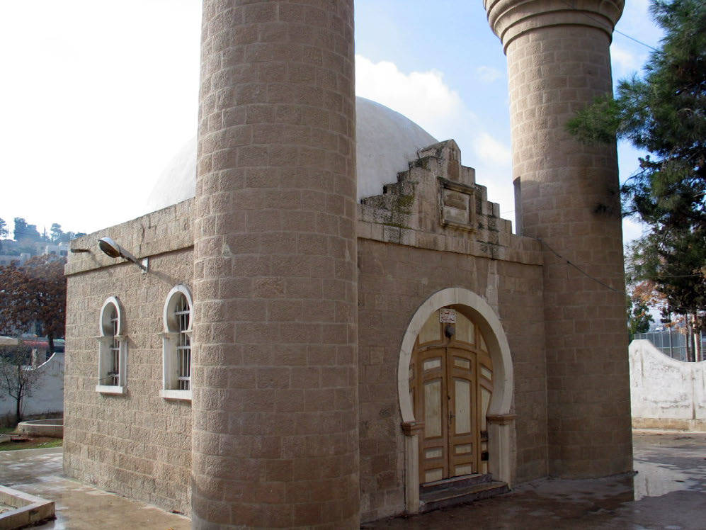
Plan: free standing square with entrance in the N and miḥrāb in S walls; two cylindrical minarets at the cor- ners of the N façade (fig. 33.6), in neo-Ottoman style. Opposite of the N side is a free standing madrasa.
Measurements: unknown.
Exterior: unknown.
Interior: unknown.
Building Materials: local limestone.
Construction details: well dressed limestone blocks. The prayer hall is covered by a semiglobular concrete dome.
Preservation: intact, used for Muslim prayer.
Inscription(s): above the entrance white marble slab with an Arabic inscription in three lines:


Translation: “This mosque has been established by the commander of the Arab army in the year H 1353 / 1933 AD” (NAt).
Date(s): In 1933 the construction of this mosque was or- dered by the Arab Legion Commander – Frederick Peake Pasha, and probably materialized through the Pu- blic Works Department (PWD) by an Istanbul educated engineer or by an engineer from the Hijaz Railway, as this was the procedure of building the az-Zarqā’ camp and the initial design for the CBR residence. The hole compound has been recently renovated.
Traveler Reports: None known.
Bibliography: Shawash 2003, 79-83; Rjoub 2016, fig. 5; Almudarra et alii 2018, 106; Haroub 2019, 38-41.